A new map is now available showing ThamesWey’s heat, cooling and electricity networks in Woking town centre, along with information about the buildings connected to our district energy supplies.
A new map is now available showing ThamesWey’s heat, cooling and electricity networks in Woking town centre, along with information about the buildings connected to our district energy supplies.
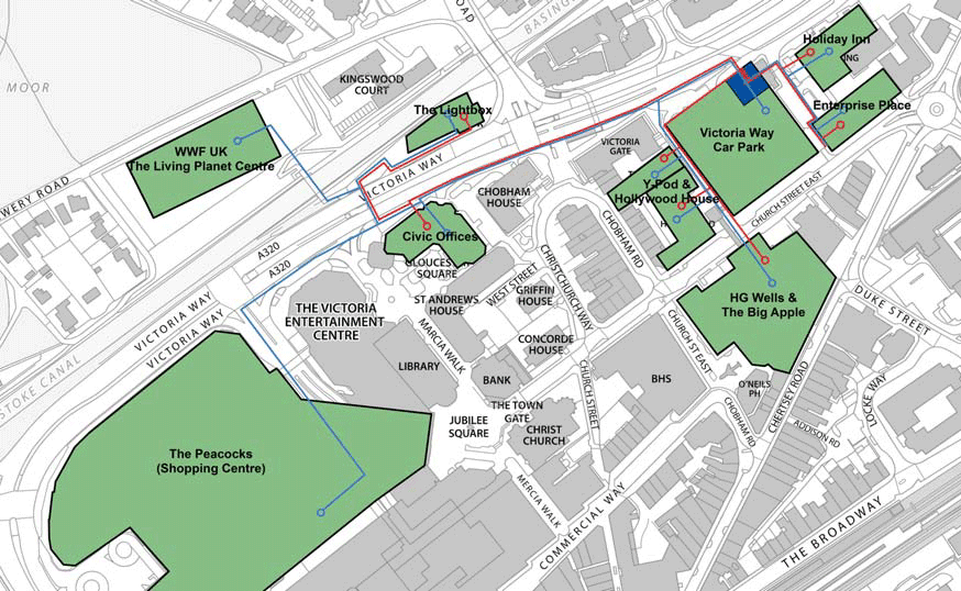
The map will be of particular interest to developers as it shows the location of ThamesWey’s networks in relation to the District Heat zones defined by the local planning authority in its Supplementary Planning Document (SPD). New development is expected to connect to district energy supplies, or be future-proofed to enable connection when the network is extended, as described in the Council’s SPD.
The energy map is the latest addition to our web resources.